Datei:Millennium Island, Kiribati.jpg
Originaldatei (2.832 × 4.256 Pixel, Dateigröße: 6,48 MB, MIME-Typ: image/jpeg)
Beschreibung
| Beschreibung |
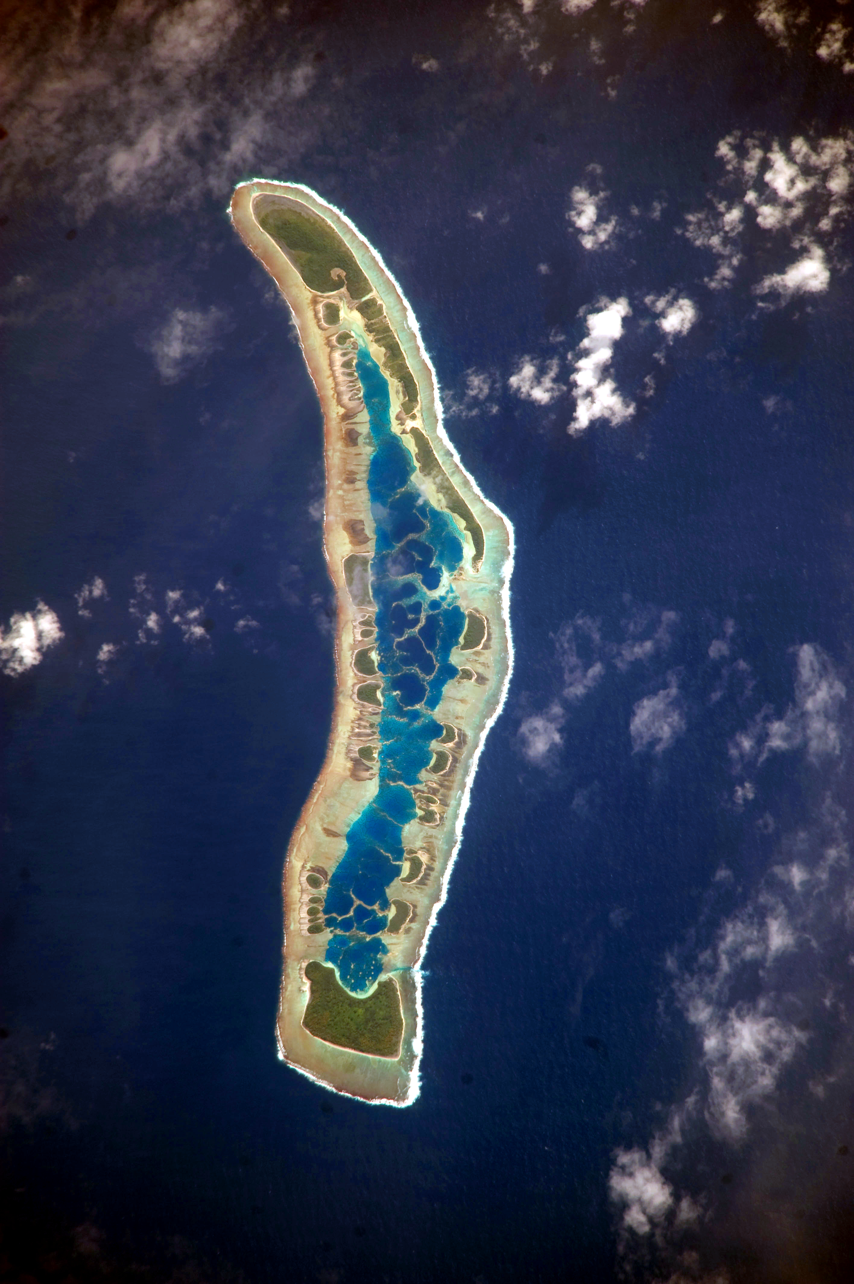
English: The islets of Millennium Island are readily visible in this astronaut photograph as irregular green vegetated areas surrounding the inner lagoon. The shallow lagoon waters are a lighter blue than the deeper surrounding ocean water; tan linear “fingers” within the lagoon are the tops of corals. The two largest islets are Nake Islet and South Islet, located at the north and south ends of Millennium Island respectively.
Français : Vue satellite de l'île du Millénaire dans les Kiribati, où l'on peut distinguer ses différents îlots, son lagon intérieur où des couleurs plus claires indiquent une profondeur plus faible ainsi que sa végétation dense sur certains îlots.
|
||||||||||||||||||||||||||||||||||||||||||||||||||||||
| Datum | |||||||||||||||||||||||||||||||||||||||||||||||||||||||
| Quelle | NASA Earth Observatory | ||||||||||||||||||||||||||||||||||||||||||||||||||||||
| Urheber | Image taken by the NASA Expedition 20 crew | ||||||||||||||||||||||||||||||||||||||||||||||||||||||
| Kameraposition | | Dieses und weitere Bilder auf OpenStreetMap |
|---|
Diese Mediendatei wurde vom Johnson Space Center der US-amerikanischen National Aeronautics and Space Administration (NASA) unter der Datei-ID ISS020-E-16279 kategorisiert. Diese Markierung zeigt nicht den Urheberrechtsstatus des zugehörigen Werks an. Es ist in jedem Falle zusätzlich eine normale Lizenzvorlage erforderlich. Siehe Commons:Lizenzen für weitere Informationen. Sprachen:
|
This image was acquired with a Nikon D3 digital camera fitted with an 800 mm lens, and is provided by the ISS Crew Earth Observations experiment and Image Science & Analysis Laboratory, Johnson Space Center. Instrument: ISS - Digital Camera
Lizenz
| Diese Datei ist gemeinfrei (public domain), da sie von der NASA erstellt worden ist. Die NASA-Urheberrechtsrichtlinie besagt, dass „NASA-Material nicht durch Urheberrecht geschützt ist, wenn es nicht anders angegeben ist“. (NASA-Urheberrechtsrichtlinie-Seite oder JPL Image Use Policy). | ||
 |
Warnung:
|
Dateiversionen
Klicke auf einen Zeitpunkt, um diese Version zu laden.
| Version vom | Vorschaubild | Maße | Benutzer | Kommentar | |
|---|---|---|---|---|---|
| aktuell | 12:04, 13. Jun. 2017 | | 2.832 × 4.256 (6,48 MB) | wikimediacommons>SteinsplitterBot | Bot: Image rotated by 90° |
Dateiverwendung
Die folgende Seite verwendet diese Datei:


