Datei:1775 Bonne Map or Chart of the Spheres and Compass Rose - Geographicus - Spheres-bonne-1775.jpg
Aus Klexikon – das Kinderlexikon

Größe dieser Vorschau: 781 × 600 Pixel. Weitere Auflösungen: 313 × 240 Pixel | 625 × 480 Pixel | 1.001 × 768 Pixel | 1.280 × 983 Pixel | 2.560 × 1.965 Pixel | 3.500 × 2.687 Pixel.
Originaldatei (3.500 × 2.687 Pixel, Dateigröße: 1,93 MB, MIME-Typ: image/jpeg)
| Rigobert Bonne: Französisch: Sphère de Ptolomée. Sphère droite. Sphère parallèle. Rose de Boussole avec les noms des Vents en usage sur l’Océan. Rose de Boussole avec les noms des Vents qu’on employe sur la Méditerranée.
( |
|||||||||||||||||||||||
|---|---|---|---|---|---|---|---|---|---|---|---|---|---|---|---|---|---|---|---|---|---|---|---|
| Künstler |
|
||||||||||||||||||||||
| Titel |
Französisch:
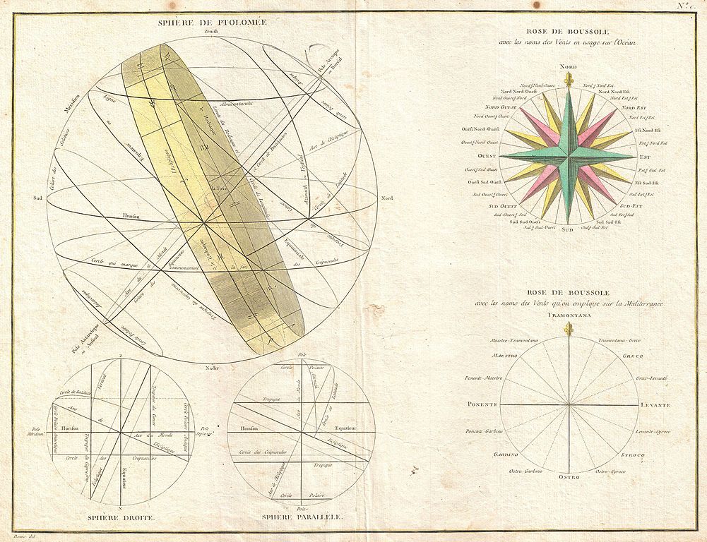
Sphère de Ptolomée. Sphère droite. Sphère parallèle. Rose de Boussole avec les noms des Vents en usage sur l’Océan. Rose de Boussole avec les noms des Vents qu’on employe sur la Méditerranée. |
||||||||||||||||||||||
| Beschreibung |
English: A beautiful example of Rigobert Bonne's curious decorative chart of the Spheres. Features five different spheres used in mapmaking and calculating map projections. From top left, Sphere de Ptolomee, Sphere Droite (Right Sphere), Sphere Parallele (Parallel Sphere), Rose de Boussole (Compass Rose), and another Rose de Boussole (Compass Rose). Drawn by R. Bonne around 1775 for issue as plate no. C in Jean Lattre's 1776 issue of the Atlas Moderne . |
||||||||||||||||||||||
| Datum | 1775 (undated) | ||||||||||||||||||||||
| Maße | Höhe: 13,5 in (34,2 cm); Breite: 17,5 in (44,4 cm) | ||||||||||||||||||||||
| Inventarnummer |
Geographicus link: Spheres-bonne-1775 |
||||||||||||||||||||||
| Herkunft/Fotograf |
Lattre, Jean, Atlas Moderne ou Collection de Cartes sur Toutes les Parties du Globe Terrestre, c. 1775.
|
||||||||||||||||||||||
| Genehmigung (Weiternutzung dieser Datei) |
|
||||||||||||||||||||||
| Andere Versionen | |||||||||||||||||||||||
.jpg)
Dateiversionen
Klicke auf einen Zeitpunkt, um diese Version zu laden.
| Version vom | Vorschaubild | Maße | Benutzer | Kommentar | |
|---|---|---|---|---|---|
| aktuell | 17:44, 23. Mär. 2011 | | 3.500 × 2.687 (1,93 MB) | wikimediacommons>BotMultichillT | {{subst:User:Multichill/Geographicus |link=http://www.geographicus.com/P/AntiqueMap/Spheres-bonne-1775 |product_name=1775 Bonne Map or Chart of the Spheres and Compass Rose |map_title=Sphere de Ptolomee. |description=A beautiful example of Rigobert Bonne' |
Dateiverwendung
Die folgende Seite verwendet diese Datei:


